
HARRISONBURG VA: (Rocktown Now) – A warm front over southern Virginia will slowly move north over the next few days, bringing an increased chance for showers and thunderstorms. The moist, southerly flow of air will increase the chance for heavy downpours with any storms.
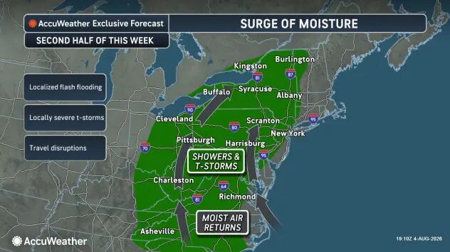
Meanwhile, humidity will increase, especially as we head toward the weekend, setting us up for some typical August like weather. Hot and humid, with a daily chance for thunderstorms.
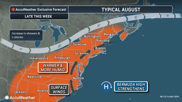
The hottest air temperatures will be the first of next week, but the humidity will help make it feel like the low 90’s by the end of the week. The chance for strong to severe storms increases from Thursday into the weekend.
The WSVA local AccuWeather forecast for Harrisonburg and the Shenandoah Valley
Tonight: partly to mostly cloudy with a thunderstorm in spots this evening, then fog late and humid. Low 68. Winds south-southwest 4-8 mph.
Tomorrow: humid with variable cloudiness; a couple of showers and a thunderstorm in the afternoon. High 88. Winds south-southwest 6-12 mph.
Tomorrow night: a thunderstorm in spots in the evening; otherwise, partly cloudy and humid. Low 67. Winds south-southwest 4-8 mph.
Friday: times of clouds and sun with a couple of showers and a thunderstorm; humid. Storms can bring flooding downpours and localized damaging wind gusts. High 86. Winds southwest 6-12 mph.
Saturday: humid with some sun, then turning cloudy; a thunderstorm in the afternoon. Storms can bring flooding downpours and localized damaging wind gusts. High 87. Winds west southwest 4-8 mph.
Sunday: partly sunny and humid with a thunderstorm in spots in the afternoon. High 89. Winds
light and variable.
Monday: hot and humid. A thunderstorm in spots. High 90. Winds west 4-6 mph.
Sunset today 8:21 p.m.
Sunrise Thursday 6:21 a.m.
Moonset today 1:39 p.m.
Moonrise 11:48 p.m.
Historical weather data for this date at the Dale Enterprise Weather Station
High: 101 in 1930
Low: 41 in 1912
Precipitation: 1.40 in 1956